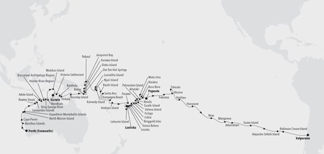
This unique Expedition voyage takes you from the shores of Western Australia all the way to South America. Get ready for a 75-day, once-in-a-lifetime journey will visit places you’ve never even heard of nestled in the Pacific Ocean. You’ll mingle with extraordinary wildlife on the Abrolhos Islands, often called the “Galápagos of the South,” and explore the rugged unspoiled beauty of Australia’s Kimberley Coast. You’ll also get an in-depth look at the traditions, cultures and myths of Papua New Guinea and enjoy diving and snorkelling in island paradises including Tonga, French Polynesia and Fiji.


Highlights


• Abrolhos Islands: Experience the remarkable biodiversity of the Abrolhos Islands, often referred to as the "Galápagos of the South," where you'll have the opportunity to encounter extraordinary wildlife and explore the pristine natural surroundings.

• Kimberley Coast, Australia: Immerse yourself in the rugged and unspoiled beauty of Australia's Kimberley Coast, where towering cliffs, ancient rock art, and breathtaking landscapes await your exploration.

• Island Paradises: Dive into the crystal-clear waters and vibrant marine life of island paradises like Tonga, French Polynesia, and Fiji, where you can indulge in world-class diving and snorkeling while enjoying the idyllic tropical surroundings.

Coming in at number seven on Lonely Planet’s list of best places to live, Fremantle has finally begun to shake off the shadow of neighbouring big brother Perth. With just 20 kilometres separating the two cities, Perth, with its happy hippie vibe has long been the big pull for visitors to the region. But Fremantle’s colourful past and bright future gives Perth as good as it gets. The coastal city has undergone a complete revamp since the America’s Cup thrust Fremantle into the spotlight in 1987. Over AUS$ 1,3 billion has been poured into revamping the city, and the fruits of the city’s labour are ripe for picking. Investment in the arts has brought Fremantle to the fore of thriving urban culture, while generous grants for small businesses has led to groovy live-music rooms, hipster bars, boutique hotels, left-field bookshops, craft-beer breweries, Indian Ocean seafood shacks amid the buskers and beaches. If that doesn’t not sound like your glass of beer, we guarantee a stroll along the wooden riverside walkway will change your mind. The city also enjoys another, rather different status. Fremantle was one of Australia’s penal cities, vestiges of which can still be found in Fremantle Prison. Almost 10,000 convicts were condemned to life imprisonment here between 1850 and 1868, but the prison remained in use until 1991. Today, the memorable sandstone building is a UNESCO World Heritage Site and at just 15 minutes from port is well worth a visit. Just don’t forget your get out of jail free card.
Human drama and nature rival each other to be the most fascinating drawcards of the Houtman Abrolhos or Abrolhos Islands. In 1629 the Dutch ship Batavia was wrecked, with most crew and passengers reaching dry inhospitable Beacon Island. Thus, began a horror story of mutiny, betrayal, rape, murder of children and survival. On one island, soldiers built a stone stockade which is the first European structure in Australia. Eventually the remaining survivors were rescued, and the murderers were hung on one island or marooned on the mainland (Australia’s first European settlers). A century later, desperate survivors of another wrecked Dutch ship Zeewijk lived (or died) for ten months on the islands. Life in the sea is an unusual mix. The warm southward-flowing Leeuwin Current meets cool southern waters at Abrolhos creating homes for both tropical and temperate marine life. A diverse coral reef grows beside cool water algae. Two thirds of the 400 fish species are tropical, while cool water-favouring Australian Sea-lions and Western Rock Lobsters (Australia’s most valuable fishery) are close to their northern limit. Seabirds, like the cooler climate Pacific Gulls, mix with tropical species like Bridled and Roseate Terns. The only colony of the Australian Lesser Noddy breeds here, along with two million Wedge-tailed Shearwaters. On land, amongst the Nitre shrubs and Saltbushes, are Abrolhos Painted Quails and Dwarf Bearded Dragons and shy Tammar Wallabies. Their ancestors survived the hungry castaways.
Shark Bay is Australia’s largest bay, with a beach stretching over 1,000 kilometers. François Peron National Park lies within the Shark Bay World Heritage area and adjacent to the Shark Bay Marine Park. This is where the rust-red desert sand meets the dazzling white-sand beach and the azure waters of the sea. At the northerly tip of the national park is Cape Peron, sitting at the confluence of two major currents, the cape attracts an impressive array of marine life. Take a hike with the expedition team from Cape Peron to the Skipjack Point viewing platforms, perched on the cliff edge with views out across the marine park. Alternatively, join the expedition team for an interpretive nature walk through the impressive landscape of acacia-cloaked red dunes and arid shrublands surrounded by turquoise water with views over the coastline.
A spectacular collision of colour spills across the seabed around North Muiron Island - which has to be one of the best spots in the world for snorkelling and scuba diving. Immerse yourself in this underwater universe as tiny fish flit between the corals, and elegant rays sweep gracefully past. Sitting off the North West Cape, the two utterly unspoiled Muiron Islands are part of the UNESCO World Heritage Site listed Ningaloo Coast. Warm Indian Ocean waters collide with the cooler waters of the West Australian Current here, forming a remarkable biological hot spot that thrives with rich life and incredible diversity. These unique conditions form masses of plankton for gentle giants of the ocean to graze upon - even luring groups of the ocean’s biggest fish - colossal whale sharks. From March to July, the cows of the sea carefully vacuum the sea bed for their food. Other massive mammals, like dugongs, dolphins, and pilot whales, also drop in throughout the year. Snorkel to look into the riot of activity below the undulating waves. Spot turtles, parrotfish and butterfly fish among the thousands of species at home in these balmy waters. A true Gem of Western Australia’s Coral Coast, the remarkable reefs of North Muiron Island serve up a brilliant banquet of colour and curiosity.
Montebello is Italian for ‘beautiful mountain’. What a misnomer! The islands are low, flat and arid. They were named by French Explorer Nicolas Baudin in 1801 after a battle in Italy. The war-like name may suit, as the British used the islands for three nuclear bomb tests in the 1950s. Today visitors must avoid two radioactive islands. Other islands are okay to explore. Two endangered mammals—the Mala (Rufous Hare-Wallaby) and the Djoongari (Shark Bay Mouse)— thrive here. They were almost wiped out by introduced cats and foxes on the mainland and were brought to this island ark for safety. The 170 islands are 120 kilometres (75 miles) off mainland Australia. Aboriginal people visited until eight thousand years ago, when rising sea levels after the last ice age made them too far offshore to reach. The next visitors were in 1622 when survivors of the wrecked British ship Tryall reached the arid islands. Porcupine Grass or Spinifex grows on rocky areas while wattle shrubs favour sand. The islands are an important seabird breeding colony. Look for Roseate and Greater Crested Terns. Sooty Oystercatchers forage on the rocks while Beach Stone-curlews roam beaches. Coral reefs and lagoons surround the islands in the Montebello Marine Park. One hundred and fifty species of hard coral, 450 species of fish and 170 species of echinoderms (sea stars, sea urchins and sea cucumbers) keep snorkellers happy. Green, Hawksbill and Flatback Turtles nest on beaches and provide highlights when seen in the water.
Some 300 kilometers northwest of Broome, the Rowley Shoals consists of the three reefs Imperieuse, Clerke and Mermaid. The first two reefs form the Rowley Shoals Marine Park and have sandy cays that will still be visible at high tide. Bedwell Island, a small sandy cay inside Clerke Reef, is home to one of Western Australia’s two colonies of Red-tailed Tropicbirds. Other birds nesting on the island are Wedge-tailed Shearwaters, White-bellied Sea-Eagles, Eastern Reef-Egrets and terns. The Mermaid Reef Commonwealth Marine Reserve is slightly further northeast and is the closest to land.
Declared an A-class nature reserve in 1970, the Lacapede Islands are a little paradise for bird lovers. Its brown booby colony, possibly the largest on the planet, awaits you with a joyful cacophony. Even if located just off the impressive Kimberley Coast, an expedition to the Lacepedes feels like discovering a wild and remote place. If some might call them ‘Australia’s Galapagos’, they were actually named after French naturalist Bernard Germain de Lacépède, who studied many Australian fish species. Before becoming a protected natural reserve, the Lacepedes also witnessed bleak moments - the islands used to be the place where kidnapped Aborigines were held before being sent to work in the pearl industry. Their unique location makes the Lacepedes an important breeding centre for many birds and marine life species. Masked Boobies, Australian Pelicans, Lesser Frigate Birds but also the endangered Green Turtle populate the islands. Our Zodiac excursions are the most ideal way to admire the ballet of birds flying in this stunning West Australian scenery. Nature lovers or not, prepare to be amazed.
Appearing like a charmed apparition, Adele Island is an oasis of tranquillity peeking out of the Indian Ocean. It’s hard to capture the sense of quiet perfection as you stand on this sandy paradise, 65 miles away from Kimberley’s rugged coast. The changeable sands of the island expand and contract with the contented sighs of the tides, and wide sandbanks ebb and flow with the whims of the water. At the core of Adele Island is a gorgeous tidal lagoon, rich in biodiversity. The island is a thriving ocean outpost for breeding birds and turtles, and the hospitable waters form a lively nursery for young humpback whales and bottlenose dolphins. Keep an eye out for large silhouettes sliding just below the shallow surface. The knee-deep sea here means you can easily spot wonderful sea creatures swimming agilely past. Keep your wits about you though, there may also be beady-eyed crocodiles, slaloming menacingly. Encounter beautiful sea turtles, diverse fish life, and remarkable birds like the lesser frigate bird and brown booby, all while exploring this pristine island gem. Stand in awe as plumes of seabirds rotate around you like a gentle whirlwind. Endless fields of immaculate coral reefs coat the seabed, alive like underwater cities, bustling with life and characters. With only the sounds of rhythmic waves sloshing, sandy footsteps crunching and vocal bird life singing out, melodic Adele Island hits all the right notes.
Set off the coast of Western Australia, the Buccaneer Archipelago is one of the Kimberley’s finest secrets. The Archipelago, 50 k2 (19 sq mi), is made up of around 800 islands and protect the mainland from the huge 12 metre tides and astonishing speed of the Yampi (or, in traditional Aborigine, “Yampee”) Sound. The speed and power of the water many not make for pleasant bathing, but do however result in fantastic natural phenomena. One fine example is the horizontal reversible waterfall in Talbot Bay. The tidal pull is responsible for the “reversible” nature of the falls, however, this also hides narrow gaps between the islands, making for treacherous sailing conditions. Isolated graves of sailors and divers are testimony to the danger. William Dampier sighted the Archipelago in 1688 but it would not be until 1821 that the Archipelago would become known as Buccaneer (a term coined by Captain Phillip Parker King) "in commemoration of William Dampier’s visit to this part of the coast ". Commander John Lort Stokes also noted the area in his 1838 record. Enterprising individuals were initially attracted to the Buccaneer Archipelago in the 1800s due to the superior pearling as well as the rich iron ore deposits. Pearling conducted by luggers in the 1880s was concentrated in Cygnet Bay, Cascade Bay, Cone Bay and Strickland Bay. More recently, mining operators established open-cut mines on Koolan Island on the east side of the Sound. Some of the richest iron ore in the world is extracted here to this day.
The Hunter River is home to an immense mangrove system surrounded by soaring red sandstone cliffs. Narrow mangrove channels shelter numerous bird species, mudskippers, fiddler crabs and the infamous saltwater crocodile; the most aggressive crocodile species known to man. Naturalist Island at the mouth of the river has a stunning stretch of sandy beach that makes a perfect landing site for small helicopters that can pick up visitors wishing to explore some of the Kimberley’s vast interior. The highlight inland is the famous Mitchell Falls where four tiers of waterfalls plunge into deep pools that flow out into the mighty Mitchell River. The headwaters of the falls are cool and a dip in the fresh water is a welcome reprieve from the heat of the heartland.
The King George Falls is one of the Kimberley’s most magnificent natural wonders. At 80 meters (260 feet), the thundering spectacle of twin cascades are among the highest in Australia. The river weaves through an amazing landscape of near vertical red rock formations and a parade of wildlife — carnivorous saltwater crocodiles and amazing birdlife, including giant raptors and the Brahminy Kite.
Wyndham is a small settlement with the spirit of a Kimberley outback township. It was established in 1886 with the Halls Creek gold rush and sits on the Cambridge Gulf where several rivers converge. Today Wyndham has a population of roughly 900 people and operates largely as a port exporting cattle, servicing the mining industry and hosting a few small ships. For these vessels Wyndham is a gateway to the nearby Ord River. Conversely, cruising the peaceful and tree-lined Ord River is a chance to look for freshwater crocodiles, fruit bats, short-eared rock wallabies and a variety of birds, including Mangrove Herons and Mangrove Gerygones. Please note: All destinations on voyages in the Kimberley region, and the order in which they are visited, are subject to tidal variations and weather conditions.
Days at sea are the perfect opportunity to relax, unwind and catch up with what you’ve been meaning to do. So whether that is going to the gym, visiting the spa, whale watching, catching up on your reading or simply topping up your tan, these blue sea days are the perfect balance to busy days spent exploring shore side.
The eastern part of Indonesia is a true paradise on Earth. Home to countless beautiful, unexplored destinations that have not enjoyed the tourism boom that many other parts of the country have. Matakus Island is one such destination. This makes it a perfect place for those who have a sense of adventure and truly want to explore off the beaten path. Matakus is a small island and part of the Tanimbar archipelago. At just over two miles in length and less than a mile across, it is one of the smaller islands but, despite its small size, its proximity to the regional capital city of Saumlaki just to the north ensures that the island is inhabited (current population 100). The tourism infrastructure is practically inexistent, so don’t expect to be souvenir shopping here – ordering a lunch of delicious freshly caught and grilled fish from one of the local fishermen that line the shore is about the maximum! Birds including the Tanimbar starling, Moluccan masked owl, Fawn-breasted thrush and Blue-streaked lorry all call the island home.
Days at sea are the perfect opportunity to relax, unwind and catch up with what you’ve been meaning to do. So whether that is going to the gym, visiting the spa, whale watching, catching up on your reading or simply topping up your tan, these blue sea days are the perfect balance to busy days spent exploring shore side.
"Australia's capital of the north is a uniquely tropical city, and a historically isolated outpost of this vast, diverse country. Reaching up towards the equator, a full 2,000 miles from Sydney and Melbourne, the city was named in honour of Charles Darwin by the British settlers who established a frontier outpost here. With a unique history, beautiful islands nearby, and a palette of sizzling Pacific flavours, colourful Darwin is an enchanting and exotic Australian destination. Crocodiles patrol the jungled waterways and tropical rainforests around Australia's gateway to the Top End. Explore via airboat to look down on the veiny waterways of the mist-laced Kakadu National Park. The sounds of chattering birdlife and the gentle splash of fountains and waterfalls will fill your ears in George Brown Darwin Botanic Gardens. Soak it all in, before kicking back and relaxing with a picnic and a crackling barbecue. The sunshine and famous tropical pink sunsets mean many visitors naturally gravitate to the city's soft sands to relax at spots like pretty Mindil Beach, as evening approaches. The adjoining market is filled with souvenirs and crafts stands and is the perfect great place to enjoy some fiery Asian flavours. Stroll the stalls, grab some food, and crack open an ice-frosted beer as the sunset show begins. It may be remote, but Darwin found itself on the front line during the Pacific War, as the Japanese air force unloaded their bombs onto the city in 1942. This relaxed unassuming city has a deeply resilient backbone, however, and you can explore the museums to learn more of the war's impact on Darwin, as well as the devastating effects of one of Australia's worst natural disasters, Cyclone Tracy in 1973."
Nestled into the highly indented and rainforest-cloaked coastline of the Cobourg Peninsula, about as far north as you can go in the Northern Territory, lie the historic ruins of Victoria Settlement. At first glance the remains of weathered brick chimneys suggest a civilisation hewed out of the wilderness, but as the story unfolds, they become a monument to the folly of colonial expansion in a remote and unforgiving setting. The outpost was founded in 1838 to serve as a re-supply post for ships passing through the Torres Strait, and to strengthen British territorial claims. Now, as you walk around the various crumbling structures, it’s difficult not to appreciate the vibrant jungle enclosing the site, yet this same beautiful environment must have been viewed differently by the pioneers. The suffocating climate and fever gradually weakened and whittled down the population. Isolation and infrequent visits from ships eroded the spirits of the survivors. Unappealing to reinforcements, Victoria was abandoned after 11 years. The Cobourg Peninsula has since returned to its former glory under the alias Garig Gunak Barlu National Park. Its diverse wildlife list includes 6 species of marine turtle, dugong and wild banteng cattle (threatened in their native Indonesia). Even more notable is its recognition as an internationally important wetland habitat (under the Ramsar Convention). The park is administered jointly by the Parks and Wildlife Service and the traditional landowners, the Iwaidja speaking peoples.
Elcho Island, known as Galiwinku by the indigenous Yolngu, is the largest of the Wessel Islands in Northeast Arnhem Land. The main settlement on the island’s southwestern side had started during WWII as a refuge from possible bombings of an air force base on nearby Milingimbi Island, some 70 km away. Banthula is one of the homelands on Elcho Island’s northwestern side facing the Arafura Sea. It was founded in 1979 when the Australian government encouraged the indigenous population to return to lands they had used before contact with the western world and to establish small settlements, the so-called homelands or outstations. Banthula is some 300 meters inland from Refuge Bay’s 7 kilometer long sandy shore. Some 40 Aborigines live in Banthula, almost 2% of Elcho Island’s population. The school closest to the Banthula children is some 12 km away at Gawa –it actually is one of Australia’s most remote schools. The area around Banthula has dry rain forest and an extensive mangrove growth is found around a creek at the northern end of the beach and bay. Green turtles, flatback turtles, hawksbill turtles, and Olive Ridley turtles, as well as dugong and Australian snubfin dolphins have all been recorded in and around Refuge Bay and Bridled Terns have been found nesting.
Yirrkala is an aboriginal community in northeastern Arnhem Land and has a population of roughly 800 residents. The Yolngu have been in the area for more than 40,000 years, but they only congregated here in larger numbers when the township was founded after a Methodist mission was started in 1935. This small coastal settlement became famous in the 1960s as the Yolngu opposed the opening of a bauxite mine on their land, writing (and sending) the Yirrkala Bark Petition to the Australian House of Representatives. Yirrkala is also one of the best-known locations of Aboriginal art -not only in the Northern Territories- and has the community controlled Buku-Larrnggay Mulka Art Centre and Museum. Just 10 kilometers south of Yirrkala is Wurrwurrwuy, an interesting arrangement of stones listed on the Australian National Heritage List. The stones have been set up in the mid-19th century and depict praus, canoes, sea cucumber boiling spots and houses. The arrangement of praus even indicate the division onboard the vessels, showing an excellent knowledge of non-aboriginal items connected with the Macassan sea cucumber trade.
Thursday Island – TI to locals or Kawrareg in Waiben dialect – is the ultimate Aussie retreat. Grab a cold beer, find a spot on a wooden pub deck overlooking turquoise blue seas and contemplate the remote beauty of the island. Whilst certainly not the biggest of the Torres Strait Islands, it is the most populated. That is not to say it’s a bustling metropolis. At last count, there were fewer than 3,000 residents for its 3.5 km2. The Torres Strait Islands is a 274-strong archipelago found scattered between the coasts of mainland Oz and Papua New Guinea. The origin of the name is unknown; what is certain however is that Captain Owen Stanley named neighbouring islands Tuesday, Wednesday and Friday when he visited in 1848, so it is a safe assumption that he named Thursday too. Thursday and Friday’s names were swapped about 8 years later so they appeared in weekday order. Budding explorers should note that Monday, Saturday and Sunday have yet to be found, so perhaps this could be your lucky day. The island enjoyed a lucrative pearl and shell trade until WWII, and many Japanese pearl divers became residents. This worked out well for the islanders; Thursday Island was mercifully left alone by during the extensive WWII bombings, probably because it was thought that there were Japanese nationals still living there (there weren’t). Superb and pristine example of the island’s heritage still stand, and can be seen in the Green Hill Fort, the Thursday Island Customs House and the Gab Titui Cultural Centre.
Days at sea are the perfect opportunity to relax, unwind and catch up with what you’ve been meaning to do. So whether that is going to the gym, visiting the spa, whale watching, catching up on your reading or simply topping up your tan, these blue sea days are the perfect balance to busy days spent exploring shore side.
Alotau is the provincial capital of the Milne Bay Province located in the southeast bay of Papua New Guinea. The town and surrounding area has been an important staging ground during World War II and you'll discover remains and memorials dating back or referring to the war. On a tour of the town, visitors will appreciate lovely vistas of the bay and experience the markets, which are frequented not only by locals, but also by islanders selling their products or looking for produce to take back into Milne Bay. Alotau is an important port facility for the islands and attracts many vendors of handicrafts from different islands.
Fergusson is one of the three biggest and mountainous islands in the Milne Bay Province, and part of the D’Entrecasteaux Islands. On Fergusson’s south side are the famous Dei Dei geysers — natural hot springs that periodically erupt with vapour steam next to mud pools and a warm stream. The hot springs are still used by locals to cook food in palm frond and pandanus leaf baskets placed into the boiling hot water. Birds in the area include Eclectus Parrots, Yellow-bellied Sunbirds and the endemic Curl-crested Manucode – a bird-of-paradise. Dobu is a small island in the D’Entrecasteaux Group next to Fergusson Island and Normanby Island. The island was formerly feared because of black magic and the local “witch” doctors cursing the healthy or treating the sick. An anthropological study was done by Reo Fortune in the 1930s which resulted in the book “The Island of Sorcerers”. The island is also part of the famous Kula ring. Participants in the exchange system pride themselves with mwali and soulava (armbands and necklaces) that are given and received still today and it is interesting to see how the traditional objects have been adorned with modern paraphernalia. A stroll through the main village on the northwestern tip will show the school and church and trails leading along the shore passing traditionally thatched houses and gardens.
Kuiawa (Kuyau) is one of the Trobriand Islands, the northernmost islands in the Milne Bay Province. Kuiawa is found some 200 kilometers from the province’s capital and to the southwest of Kiriwina, the largest and best known of the islands. The Trobriand Islands are of uplifted limestone and gardening is not that easy –but Trobriand Islanders are known for their magic to improve the growth of yam, a highly desired plant for ceremonial reasons and as food. Certain islands and villages have yam houses where the larger yams are stored and displayed. Houses are strung along the main road through the village and beach almond, casuarina and frangipani trees give shade. Trobriand Islanders are famous carvers and dancers and local groups and school classes love to compete dancing or playing their version of cricket, especially during harvest time.
Jacquinot Bay is a large open bay on the eastern coast of the island of New Britain. It is a tranquil place with white sandy beaches and tropical palm trees all around. There is also a well-known beautiful waterfall that flows out of the mountainside with freezing cold water right onto the beach. But during WWII, however, it was not a quiet place. It was, in fact, an important base for the Australian Army who liberated it in November 1944. This base was used to support Australian operations near Rabaul which were conducted in early 1945 in conjunction with advances on the northern side of New Britain.
If surreal and unique experiences are your thing, then the Papua New Guinean town of Rabaul should tick your travel boxes. Found on the north eastern tip of New Britain Island (the largest island off mainland PNG) Rabaul, the former provincial capital, has quite a remarkable location. The town is inside the flooded caldera of a giant volcano and several sub-vents are still quite active today! The lively city was almost entirely devastated by Mount Tavurvur in 1994, covering the city in ashfall, but thankfully costing no lives. Since then, thanks to Rabaul’s deep-water port, commerce has been on the up, and a few shops and hotels have managed to find an audience. However, Rabaul’s remote location together with the volcano still being one of the most active and dangerous in Papua New Guinea means tourism in not rife. Rabaul has an impressive WWII history which includes a 300-mile network of tunnels dug by Japanese POW designed to conceal munitions and stores. After the Pearl Harbour bombings, the Japanese used Rabaul as their South Pacific base for the last four years of WWII, and by 1943 there were about 110,000 Japanese troops based in Rabaul. Post war, the island was returned to Australia, before it was granted independence in 1975. It should be noted that patience is a virtue here. However, that is not all bad. The slow pace of transportation allows travellers to marvels at the quite astonishing landscape.
Days at sea are the perfect opportunity to relax, unwind and catch up with what you’ve been meaning to do. So whether that is going to the gym, visiting the spa, whale watching, catching up on your reading or simply topping up your tan, these blue sea days are the perfect balance to busy days spent exploring shore side.
Wild, uninhabited and historical, Kennedy Island is a tiny piece of land in the middle of the Pacific Ocean. Part of the remote Solomon Islands, the island is situated 15 min away by boat from Gizo, which is capital of the Western Province. Kennedy Island was formerly known as Plum Pudding Island, after an incident dating back to World War II. Incident involving one of the most famous figures of history. John F. Kennedy, a lieutenant at the time, was a castaway on the island with his crew when their torpedo ship, PT 109, was shot sunk by the Japanese troops in August 1943. It is said that the future president swam dragging an injured crewmate by holding the strap of his life jacket in his teeth until reaching the island. He and his crew fed themselves with coconuts during two days before being found by Solomon Islanders. JFK even kept a coconut shell from the island on his desk in the Oval Office throughout his presidency. For our history buffs, some artefacts dating from the crew’s passage can still be found on site. An island marked by history in short, but not only. Discovering Kennedy Island is an experience not to be missed for diving and nature lovers. The waters that surround the island are a submerged world of great richness and variety of colourful fishes and corals. Njari is a small island almost entirely covered in trees with just a small sand spit at its eastern end. A labyrinth of reefs and coral heads make an approach quite difficult. Recently a small wooden jetty has been built on the southern side. The small beaches invite one to relax, but swimming from the beach is almost impossible as the corals are too close. To enjoy the underwater world one has to enter the water from Zodiac snorkel platforms, a short distance from the shore, where an amazing array of fish and coral will be visible. Two hundred and seventy nine different fish species have been seen during a single dive; the fourth-highest fish count ever recorded. An indication of why this island is considered a top spot for snorkeling in the Solomon Islands.
Marovo Lagoon is one of the world’s largest saltwater lagoons. Described by American author James A. Michener as, “one of the seven natural wonders of the world,” Marovo is home to a double barrier reef system, and is one of two sites in the Solomon’s currently under consideration for UNESCO World Heritage Site status. Residents of Marovo Lagoon make elegant woodcarvings that are often for sale on the shoreline. Marovo is also renowned as one of the best diving and snorkeling spots on the planet.
Live out your most outrageous desert island fantasies amid the scarcely believable beauty of tiny Rauhi Island. Peeking out of the turquoise blue waters of the Solomon Sea, this bullet-shaped sliver of land is one of the smallest of the Solomon Islands’ 1,000 landmasses. Waiting just off the east coast of Guadalcanal, discover Rauhi Island - a tropical gem surrounded by an undisturbed collection of the most dazzling coral reefs you’ve ever seen. A tiny isle of thick emerald vegetation, its alluring ring of crisp white sand invites you to lay back and let it all go. Or enjoy beautiful swimming and snorkelling in shimmering, untroubled waters. Dugongs - or sea cows - gently graze in the warm seas around the island, and are just one example of this tropical paradise’s remarkable fauna, which comes in all shapes and sizes. Look into the balanced ecosystems of lively coral reefs, tread fine sand, and explore the shallow seas that link Rauhi with nearby Kosa Island. The glass-clear waters and sparkling sunsets are sure to leave a lasting impression, as you island-hop through the untouched beauty of the Solomon Islands.
Port Mary is the name of the bay adjacent to Ghupuna, the main village in Santa Ana. A bright white sand beach with huge shade-giving trees runs along the shoreline in front of the tidy village. The houses here are made with local materials and most are built on stilts. Islanders generally welcome visitors with traditional songs and dances performed by members of the three different villages on Santa Ana. Some local people will also set up stands offering souvenirs for purchase. The Solomons are best known for strings of traditional shell money and elegant carvings based on local stories and legends.
Days at sea are the perfect opportunity to relax, unwind and catch up with what you’ve been meaning to do. So whether that is going to the gym, visiting the spa, whale watching, catching up on your reading or simply topping up your tan, these blue sea days are the perfect balance to busy days spent exploring shore side.
As world famous beaches go, Champagne Beach is one of the big hitters. In 2003, CNN ranked it number nine in its list of top 100 beaches and independent travel specialists permanently include it on their list of 50 best beaches worldwide. It’s one of the world’s greatest natural beauties: picture-perfect beach white sand, turquoise water and nothing – save for the occasional cow or curious turtle - around. With only coconut plantations and a few friendly locals to keep you company, this might just be the island of your dreams. The glorious name “Champagne Beach” was given to the island in the 17th century, when Pedro de Quirós believed he had reached the famous unknown southern land or the “Tierra Australis Incognita” (or Australia as we now know it). He believed the effervescent bubbles of volcanic origin that bubble up from the crystal clear waters were reminiscent of the bubbles of Champagne. Additionally, the coastline is shaped like an art deco Champagne saucer, so the name stuck! The beach is located on the largest yet least populated island in the 40-island Vanuatu archipelago, near the village of Hog Harbor on Espiritu Santo Island. If you want to venture beyond the beach, then Espiritu Santu is also famed for its blue holes. The island is home to some of the clearest waters on Earth, benefiting from natural filtering from underground limestone caves.
Unlike Espiritu Santo with its raised coral reefs and white sand, Ambrym is a volcanically active island with dark sand beaches. Ambrym is known as the island of magic and is the source of five local languages that all evolved on Ambrym. This handful of languages contributes to the well over 100 languages of Vanuatu. Some of Ambrym’s magic takes place in the lush greenery of the local community of Ranon. Here the people perform a very special and traditional ‘Rom’ dance. Participants prepare their masks and costumes in secrecy and the dance is reserved for special occasions.
Days at sea are the perfect opportunity to relax, unwind and catch up with what you’ve been meaning to do. So whether that is going to the gym, visiting the spa, whale watching, catching up on your reading or simply topping up your tan, these blue sea days are the perfect balance to busy days spent exploring shore side.
Nabukeru is the largest village on Yasawa, located within the grouping of the roughly 20 volcanic islands that make up the Yasawa Islands in Fiji. Until 1987 these islands were closed to land-based tourism and could only be viewed from aboard a vessel. With their clear, aquamarine waters and ecologically diverse tropical, mountainous landscapes, these islands were the location for the filming of the romantic adventure film The Blue Lagoon (both the 1949 and 1980 versions). Opposite Nabukeru is Sawa-i-Lau, an island famous for the limestone caves of the same name. The Sawa-i-Lau caves can only be accessed by climbing stairs from the beach, passing a small door and then jumping into the larger cave’s pool. The second cave and pool can only be reached by swimming at low tide through an underwater tunnel. Nabukeru villagers assert that the cave is the heart of the Yasawas.
It doesn’t get much sweeter than arriving on the sun-soaked shores of the Sugar City. Fiji’s second-biggest settlement opens up a world of blissful beaches and turquoise seascapes, while its dense jungle lures the adventurous deep into its embrace. Step ashore where the first Fijians landed, and you'll understand instantly why they chose to make this island paradise their heavenly home. Experience rich Fijian life, and see dramatic displays like warrior dances, and remarkable local practices like firewalks, which kick up burning embers into the night's sky. Legend says the city took its name after two chiefs faced each other in a duel. A spear pierced one of the chiefs, leading to the shout of 'lau-toka!' or 'spear hit!' Sugar is Lautoka’s main trade, but its botanical gardens are a sweet insight into the tropical plant life that thrives here - from pearl white lilies to tall, fragrant orchids. Explore temples, charming cafes and mills - or barter for some of the juiciest mangoes you’ll ever taste at the city’s lively market. You'll only be able to resist the beaches for so long, and it doesn’t get much more stunning than the Blue Lagoon - a heavenly blend of woven together turquoise shades. Remote, wild and unspoiled, these are some of the best tropical beaches in the world. There's more rejuvenating relaxation at the mineral-rich mud pools and spas, fuelled by the volcanic activity below. Savala Island is a teardrop of sand offshore, and another beautiful place to wander with the soft powder between your toes - along sandy spits that peter out into the water. Or swim and snorkel among its envied reefs, thronging with fish life.
Levuka highlights both the historical and natural aspects of Fiji. The small island of Ovalau is located off the east coast of Viti Levu. The quaint town of Levuka has the honour of having been Fiji’s very first capital where King Cakobau reigned and where the deed of cession to Queen Victoria was signed in 1874. Many of the old buildings in the town have remained nearly unchanged since the late 1800s. Here one can find Fiji’s first government school, the popular Ovalau Club, and the “Cession Stone” commemorating the signing of the Deed of Cession. Just outside the city, it is possible to hike through pristine rainforest and take in the magnificent natural beauty of the surrounding area. Leleuvia is a small low-lying island southeast of Ovalau with a length of barely 500 meters. Situated between the chiefly island of Bau, Moturiki and Ovalau, almost equidistant from Ovalau and the Central Eastern coast of Viti Levu, this lush, green island hosts a small resort. An easily accessible reef with many colorful reef fish 10 meters off of Leleuvia’s western beach invites to be explored. Resident sea kraits are often seen resting ashore north of the small pier. Despite its small size and the resort on its southern side, the island still has quite an extensive forest of tamanu (Alexandrian laurel), lantern trees, fish-poison trees and beach gardenia. There are also local clusters of beach hibiscus, beach heliotrope and Pacific rosewood where Sacred Kingfishers, Orange-breasted Honeyeaters, and Pacific Swallows have been recorded.
East of Vanua Levu and Viti Levu, Vanua Balavu, the third largest of the Lau Islands, is part of Fiji’s Eastern Division. The island is protected by a barrier reef of some 130 kilometres in length. The enclosed lagoon area promises excellent snorkelling while the reef keeps larger ships at bay. Vanua Balavu has a special geological set-up: it has a volcanic part in the south and uplifted coral in the north, even hot springs and limestone caves exist. 17 villages with a total of roughly 1200 inhabitants are found along the shore of the island. Lomaloma is the island’s main village with schools, a post office, police station and a small hospital. As the Lau Group was once under Tongan rule, with the Tongan chief Ma’afu residing in the village of Lomaloma, folkloric presentations feature Fijian and Tongan music and dance and have formed a special union. There still are some 400 Tongans living in the village of Sawana, the southern part of Lomaloma.
Idyllic and picturesque with possibly the lightest, clearest blue waters on the planet, the Ringgold Isles are an archipelago in Fiji that is mostly uninhabited, but for one small village. Tree-lined hills slope down onto white sandy beaches lined with palm trees and interesting rock outcroppings in some areas. Three reefs form part of this group: the Budd, Nukusemanu, and Heemskercq Reefs. The waters surrounding these islands are favored for snorkeling and scuba diving because of their visibility down to 120 feet. Also known as Thombia Island the crescent moon-shaped Cobia Island in Fiji is part of the Ringgold Isles archipelago. The island is teeming with biodiversity on land and underwater. Cobia Island is part of the Budd Reef and has a submerged volcanic crater with its highest elevation on the west side of the island. Considered a “conspicuous landmark” for seafarers at least as far back as 1899 this tropical island embodies a unique combination of wooded areas tropical vistas and diverse sea life. The island is an important component of Fiji’s Biodiversity and Action Plan due to its unique geological formations and beach forests.
As part of the Southern Lau Group, Fulanga is one of Fiji’s easternmost islands. Fulanga has a large central lagoon with a 50-meter wide pass to the ocean on its northeastern side. The crescent-shaped raised limestone island is famous for its numerous islands, mushroom-shaped islets and many sandy beaches in the calm lagoon. Some 400 residents live in three small villages. The two villages of Muana-i-rai and Muana-i-cake are quite close together on the southern exterior side with a very narrow passage allowing access to the ocean, while Naividamu, the third village, is on the interior, i.e. lagoon side. Muana-i-cake is the main village and hosts the kindergarten and primary school, a post office and first aid station. Old-style houses made of corrugated iron are predominant with limited solar power for the odd refrigerator and television set. Although many islanders have left Fulanga to look for work in Suva, traditional crafts are still practiced by men and women. The weavers and carvers producing pandanus mats and wooden bowls for kava ceremonies are not only valued on Fulanga. Their products can leave on the monthly supply vessel and is highly sought after in Suva.
Uoleva is one of those classic postcards or webpage images of a south sea island. Clean white sand beaches, abundant coconut palms, and clear blue shallow waters with the visible shapes of coral bommies and reefs. It is easy to imagine being castaway on such an island without a care. But as with most natural places, there is always an alternative to relaxing, such as beachcombing, swimming, snorkelling and exploring the island. The coral reef has a rich display of marine life to explore with a snorkel. The warm, clear waters promote coral growth which supports animal life like feather stars, fan worms, sponges and sea squirts. Fish of many shapes, colours and habits provide you with unlimited opportunities to watch their behaviour. Some dart in and out of corals while others sit on the bottom waiting for food to pass by. Many fish gather in schools to search the reef for algae to feed on, while other schools swirl in the water column nabbing passing plankton. The island has some visitor accommodation but is still mainly used by locals for coconut growing and pig grazing. If you see a mound on Uoleva it is probably a traditional pigeon snaring trap. The Tongans boat over from the adjacent island of Lifuka, or wade over at low tide. It was at Lifuka that Captain Cook named Tonga the 'friendly islands’ after a welcome feast. Little did he know that the feast was part of a plan to slaughter him and his crew that did not quite happen. The name 'friendly' stuck though and is very appropriate today.
With a population of 6,000, Neiafu is the capital of the Vava’u Group and the second largest municipality in the Polynesian nation of Tonga (a 169-island archipelago in the South Pacific). The city is situated next to a deep- water harbor (Port of Refuge) on the south coast of Vava’u, the main island of the Vava’u archipelago in northern Tonga. The waters of this region are known for their clarity and beauty, and the area attracts many humpback whales between June and November. A popular destination in Neiafu is the ‘Ene’io Botanical Garden, a bird sanctuary that promotes the survival of exotic and native bird species as well as supports and conserves a diverse array of plant life. A typical tropical island in the South Pacific should have white sand, coconut palms, a calm turquoise sea and coral reefs reaching to the shore. Eueiki has all that. The 19-hectare (48-acre) island is one of the Vava’u island group of Tonga and is privately owned, with a small resort. Eueiki is made of limestone laid down by marine life thousands of years ago and later uplifted. Take a walk from the island’s beach to the shade of the island’s interior. Listen for birds. The names of the Polynesian Triller and the Tongan Whistler (a Vava’u endemic) give away their identity. The ‘coos’ are made by fruit-eating Pacific Pigeons or Purple-capped Fruit-doves. Screeches identify Tongan (Insular) Flying Foxes. Fascinating to watch, these large bats are sacred and protected by the King of Tonga. Coral reefs provide great snorkelling, with clear waters giving excellent views of the diverse corals and fish. Healthy corals are mostly green, brown and occasionally blue due to the algae that lives in the flesh of the skeleton-making coral polyps. It is the texture and shapes of the coral that make them fascinating. Some are soft and some are hard. Growth forms include shrubby, finger, plate, massive (round domes) and branched. Small reef fish linger on the reef, none more so than the anemonefish. Small groups of these orange, white, and sometimes black, banded fish find protection amongst the tentacles of sea anemones. Anemonefish are nicknamed Nemos after the Finding Nemo movie. Find Nemo in the word anemone.
Crossing the date line (theoretically the 180-degree line of longitude) from the Eastern to the Western Hemisphere seafaring guests will find themselves in the unusual situation of actually gaining a day and prolonging their holiday – at no extra cost! By crossing the (fictitious) line that dissects the planet exactly in half from Greenwich, you travel over time zones and find yourself with an extra day on board. The phenomenon was used by Jules Verne in his novel Around the World in 80 Days when his hero Phileas Fogg finds out he had returned home a full day earlier than calculated having always travelled towards the east. As some countries have decided to change to different time zones than allotted based on longitude, this phenomenon is not strictly linked to the 180-degree line of longitude any longer. Days at sea are the perfect opportunity to relax, unwind and catch up with what you’ve been meaning to do. So whether that is going to the gym, visiting the spa, whale watching, catching up on your reading or simply topping up your tan, these blue sea days are the perfect balance to busy days spent exploring shore side.
When Lonely Planet co-founder describes somewhere as “the world’s most beautiful island” you can be sure that you are in for a treat. Incredible Aitutaki, inspiring Aitutaki, unbelievable, idyllic and unimaginable, there are simply not enough superlatives to describe quite how amazing Aitutaki is. Brought to light in 1779 by Captain Bligh, the Mutiny on the Bounty meant that Aitutaki has something of a bloodthirsty history. While Europeans missionaries eventually settled on the island in the 19th century (evidenced by the white, coral-encrusted walls of the many churches) the island’s Polynesian history dates to around 900AD. Traditional songs and dances from this period still exist (although Christian hymns, known as “imene metua” are also popular), and are performed by islanders with gusto and much pride. The island is part of the Cook Islands, one of the most secluded and romantic archipelagos in the world. With its powder white sand, warm turquoise waters and sense of casual luxury, it is easy to see why the island has earnt itself the moniker of honeymooner’s island. However, there is much more to Aitutaki than just fun in the sun. With a reef that completely encompasses a large turquoise lagoon, Aitutaki is considered one of the most spectacular diving and snorkelling destinations in the world. Added to the tropical excitement is that when entering the main village via Zodiac along a narrow channel – travellers will be greeted by a traditional and customary warrior challenge.
The low-lying atoll of Palmerston is inhabited by three families, all descendants of William Marsters (1831-1899). Members of the community are known to greet visitors and guide small boats and Zodiacs into the lagoon through a maze of coral reef to reach the only inhabited islet –commonly called “Home”. Once ashore, the whole community generally turns out to meet visitors as it is a rare occurrence. The island’s highlights include a church, the oldest house, the cemetery, the school, the underground gardens and “Duke’s Pool,” inviting for a swim or snorkel. In the lagoon’s waters it is possible to find colorful reef-fish, sea cucumbers, rays, and sea turtles. Overhead there is birdlife including tropicbirds, boobies, noddies, frigatebirds and terns.
Days at sea are the perfect opportunity to relax, unwind and catch up with what you’ve been meaning to do. So whether that is going to the gym, visiting the spa, whale watching, catching up on your reading or simply topping up your tan, these blue sea days are the perfect balance to busy days spent exploring shore side.
If you have ever dreamt up your ideal island holiday, we suspect it goes something like this: Soapy blue seas? Check. Sparkling white beaches? Check. Thatched wooden huts, gently sloping palm trees and kaleidoscopic marine life? Check, check and check. And yet, even by ticking every box, first time viewing of Bora Bora still beggars belief. This tropical hideaway less than 12 m2 in the heart of the South Pacific has been toping travel wish lists for years. Long considered the realm of honeymooners – spectacularly romantic sunsets are a speciality – Bora Bora is not just for wandering with your love. If the prismatic shades of blue of the world’s most beautiful lagoon do not fill you up, then perhaps underwater scooters and aqua Safaris will charge your batteries. If exploring Bora Bora’s lush hinterland is more your glass of tequila sunrise, then trips around the island (often stopping off at the celebrity haunt Bloody Mary Restaurant & Bar) are a must. Bora Bora’s peaceful ambience has not always been the case. The island was a US supply base, known as “Operation Bobcat” during WWII. During this time, Bora Bora was home to nine ships, 20,000 tons of equipment and nearly 7,000 men. Eight massive 7-inch naval cannons were installed around the island, all but one of which is still in place. Although little is known of the history of the island, it is known that Bora Bora was called Vava’u in ancient times. This supports belief that the island was colonised by Tongans prior to French annex in 1888.
Known as the "Sacred Island," Raiatea is a fascinating haunt for archaeologists and historians as it's one of the islands in the Pacific where Polynesian culture can trace its roots. Visitors will find many of the older Polynesian structures still in place and are fascinating places to explore. In the 16th century, Raiatea developed a powerful cult dedicated to Oro the God of War and built a large meeting ground, the Taputaputea Marae, which is still intact. Human sacrifice was practiced until around the middle of the 18th century and visitors should look for the sacrificial stone. Several tour operators run visits to the marae (ancient temples) along with some degree of informed commentary—although in fairness Polynesian storytelling can embellish things a little. The Faaroa River is the only navigable waterway in French Polynesia and it can be traveled by powerboat or outrigger canoe. Running through the Faaroa Gorge it passes some spectacular scenery with steep-walled jungle foliage holding dozens of bird species and wild hibiscus. Trekking up Mount Temehani, a well-known landmark that's said to be Oro's birthplace, is relatively demanding. Keep a lookout for the rare, five-petal tiare apetahi. Said to be impossible to grow anywhere else, this white, indigenous flower can only be found above 1,300 feet (396 meters). Look, but don't touch. It's against the law to pick them. If the Society Islands were a jewel, Motu Iriru would be one of its tiny pearls. Take your mask, your tuba and your sunscreen. It’s time to relax and fully enjoy this matu – Polynesian name for the lagoon's tiny islands. This uninhabited little piece of land is facing the ‘sacred island’ Raiatea, cradle of the Maori people according to Polynesian mythology. The perfect place to slow down time, to chill and to admire the the horizon joining the sea, which comes in every shade of blue. These glittering emerald waters are home to colourful fishes with a coral garden for playground. Entering the ocean, you’ll get the opportunity to get to know inoffensive and friendly baby blacktip sharks, the shallow coastal waters being their favourite.
Papeete is the center of the tropical paradise of French Polynesia, where islands fringed with gorgeous beaches and turquoise ocean await to soothe the soul. This spirited city is the capital of French Polynesia, and serves as a superb base for onward exploration of Tahiti – an island of breathtaking landscapes and oceanic vistas. A wonderful lagoon of crisp, clear water begs to be snorkelled, stunning black beaches and blowholes pay tribute to the island's volcanic heritage, and lush green mountains beckon you inland on adventures, as you explore extraordinary Tahiti. Visit to relax and settle into the intoxicating rhythm of life in this Polynesian paradise.
Fakarava is oblong shaped and has an almost continuous string of reef and motu stretching for 40 km (25 mi) on its eastern edge. It's the second largest of the Tuamotu atolls, located 450 km (280 mi) northeast of Tahiti, and 120 km (75 mi) southeast of Rangiroa. It's renowned for the drift diving in its two passes—Garuae (also spelled Ngarue) in the north near the main town of Rotoava (and the airport) and Tamakohua Pass, 48 km (30 mi) across the lagoon in the south. The tiny village of Tetamanu, situated by the southern pass, was once the capital of the Tuamotus and houses the first church built in the archipelago in 1874. In 2006 the entire atoll was deemed an UNESCO biosphere reserve; to preserve the lagoon no overwater bungalows have been built in it. Fakarava was "discovered" by Russian explorer Fabian Gottlieb Von Bellingshausen in 1820; some 20 years later missionaries arrived, in the guise of fanatical Catholic priest Honore Laval, and began building churches.
Days at sea are the perfect opportunity to relax, unwind and catch up with what you’ve been meaning to do. So whether that is going to the gym, visiting the spa, whale watching, catching up on your reading or simply topping up your tan, these blue sea days are the perfect balance to busy days spent exploring shore side.
The largest of the southern islands, Hiva Oa, the master pillar or finial post of the ‘Great House’ - which represents the Marquesan archipelago in the local mythology - has always been the rival of Nuku Hiva. The island is shaped like a seahorse and has a mountain range running southwest to northeast whose main peaks, Mt. Temetiu and Mt. Feani form a real wall around Atuona. Atuona, a peaceful little port at the head of the Taaoa Bay, also known as Traitors Bay, has emerged from obscurity due to having had the privilege of being the last resting place of Paul Gauguin and of the singer Jacques Brel. The tombs of these famous personalities are on the side of the Calvary cemetery looking out across the bay and are places of great pilgrimage. In the village, the Gauguin Museum displays items related to the painter's stay there at the beginning of the century and has copies of his works. If you’re looking for a perfect incarnation of Polynesia’s unparalleled beauty, you just found it. Discover mesmerising Tahuata and unveil all its secrets. Part of the Marquesas, this is the tiniest inhabited island of the archipelago, with only 700 inhabitants. This croissant-shaped piece of land was discovered in 1595 by Spanish navigator Alvaro de Mendana de Neira and has been a dreamy destination for many travellers since. Indeed, its spectacular and idyllic scenery, made of contrasts between impressive mountains and sandy beaches, would inspire every poet – and not only! How can’t you be impressed admiring Meae Ufa, a 3181-feet volcano and the stunning twin bays Ivaiva Nui and Ivaiva Iti? The island is also nicknamed ‘Monoi Island’ thanks to the great quality of its tiaré oil, heritage of traditions and secrets orally transmitted generation to generation. Tahuata has a huge reputation across French Polynesia for another savoir-faire, its rich craftsmanship. The craftsmen excel at carving beautiful pieces, spears, puzzles, dishes they produce on bone or rosewood. These unique creations are exhibited in the craft centre of the pretty village of Hapatoni and in the Vaitahu Town Hall Museum. Very close to one another (15-min boat ride or 30-min walk), these two tiny villages are absolutely worth a visit with their charming mixt of Polynesian and European atmosphere. And don’t forget to have a swim at Hana Moenoa beach, the island’s most beautiful one. Maybe you’ll come across sea turtles in its crystal-clear waters.
Shrink before stadium-sized bays of deep water and folded valleys clad with dense green jungle, on arrival in Hatiheu. You’ll be warmly welcomed to this raw and ravishing island of natural beauty, legend and awe-inspiring views. Nuku Hiva is the largest of the Marquesas Islands, which are strung across a blissfully blue Indian Ocean. Remote and wonderful, you can find waterfalls tumbling from cliffs, volleyball-sized breadfruit clustering in trees, and incredible sacrificial sites and petroglyphs. Explore to see cinematic views of sprawling bays unravelling, while on breathtaking mountain hikes and drives. Or take it easy, strolling by the water and watching yachts mingling in the turquoise seas, as sharks circle for offcuts tossed by fishermen. Wild horses trot tight streets, and pigs shuffle through the undergrowth, clambering up and down dense mountainsides. Journey south to see the Tiki Tuhiva carving watching out over rich-blue waves. The gigantic statue is a proud example of the island’s resurgent culture, which was almost extinguished by European colonists. Take the chance to duck out of the afternoon sun into the stone-walled shelter of Notre Dame Cathedral, which is decorated with carved sculptures and soaring wooden eaves. The church’s crooked towers rise incongruously from the rainforest’s tangle - follow the ethereal sounds of choral singing to find it. Nuku Hiva’s ceremonial sites, crafts and stone statues add further layers of intrigue to this magical Pacific island.
Situated in the middle of the Pacific Ocean, Fatu Hiva is the most isolated island of the most isolated archipelago on the planet. Sometimes called the ‘island at the edge of the world’, Fatu Hiva is also the greenest, wildest and most mountainous island of the Marquesas. And what mountains! The island’s dramatic cliffs and lush valleys, illuminates the extraordinary Polyenian countryside, will give you the impression of being in a Paul Gauguin painting. On your arriving in this tropical paradise, you’ll be welcomed with the traditional welcome to the Marquesas Islands, ‘Mave Mai’, involving ancestral dances. Let yourself be carried away by the Haka rhythm before discovering the charming village of Hanavave. After strolling among the village’s picturesque fare houses, the authentic Marquesan constructions, uncover the island’s hidden gems and secrets. Stunning waterfalls hurling down from impressive peaks forming magnificent lagoons and rushing fresh rivers. Nothing better than a hike to properly appreciate and admire the fabulous scenery that surrounds you. Real highlight of the island, the spectacular Baie des Vierges is said to be one of the most beautiful bays on Earth. These crystal-clear waters are home to myriad of marine life species like manta rays or sea turtles swimming into a ballet of multicolour fishes. What more do you need to believe Fatu Hiva is a true paradise?
Days at sea are the perfect opportunity to relax, unwind and catch up with what you’ve been meaning to do. So whether that is going to the gym, visiting the spa, whale watching, catching up on your reading or simply topping up your tan, these blue sea days are the perfect balance to busy days spent exploring shore side.
Blink and you’ll miss it, Reao is a dazzling drop of paradise, peeking from the immensity of the South Pacific Ocean. It would be a crying shame to overlook it - Reao may be remote, but few places pack such an immediate punch of peace and tranquillity on arrival. Pukarua Atoll is Reao’s closest sibling - another tiny island, which lies 30 miles away. Cast out to the far east of French Polynesia, a handful of low buildings house the few hundred residents of Reao, who warmly welcome intrepid visitors to their far-flung island home. The atoll provides a jaw-dropping arrival - step ashore among swooning coconut palms and crystalline turquoise waters. Ringed by a fringe of pristine white beaches, the narrow loop of sand cradles a stunning interior lagoon. The heavenly water here glows with the full spectrum of evocative Pacific blue hues. Hack open fresh coconuts on the beach for their bounty of liquid refreshment, and surrender to the rejuvenating flow of island-time - where everything moves at precisely the speed it needs to, not a tick faster. The atoll’s unique ecosystem helps the island protect a cluster of unique and rare corals - like the tentacled staghorn coral - and you can seek rare shellfish and marine life in these tempting waters. Swim, dive and snorkel to your heart’s content, or luxuriate on some of the most beautiful beaches in your own personal Pacific island fantasy, as you explore this distant and dreamy corner of French Polynesia.
In the Gambier Islands of French Polynesia, Mangareva is the largest island with a population of over 1,200 people. Most live in Rikitea, the largest village on the island. A high central ridge runs the length of Mangareva peaking with Mt. Duff, which rises over 440 meters from the sea on the island's south coast. The island has a large lagoon sprinkled with coral reefs whose tropical fish and the black-lip oysters have helped islanders survive much more successfully than on other nearby islands. Small ships are able to enter the lagoon of Mangareva. Ashore visitors can walk through the town, see the remains of the massive stone and coral buildings dating back to the 19th century or climb up Mt. Duff. The highlights in town include the cathedral with its mother-of-pearl shell altar and objects designed and built in the 1830s and 1840s and partially restored by the students of Rikitea’s school just a few years ago.
Home to the original mutineers of the Bounty, Adamstown’s is today the capital of all four Pitcairn Islands. The islands – the last British Overseas Territory in the Pacific – include the namesake Pitcairn Island itself, plus the uninhabited Oeno, Henderson and Ducie. Pitcairn is the archipelago’s only inhabited island, with the population of just 50 centred in Adamstown. It is no surprise that the nine mutineers along with six Tahitian men, 12 Tahitian women and one child stopped on Pitcairn in 1790; with its sloped and varied landscape, lush tropical promise and equidistant location between Peru and New Zealand, Pitcairn would have seemed an ideal hiding spot for the mutineers to settle. The ship was burnt to avoid detection (the ballast stone remains of the wreck in Bounty Bay). However, the ideal bucolic life that mutineer leader Fletcher Christian had envisaged was not to be. Poor treatment of the Tahitian men led to alcoholism, chaos and carnage and by 1800 only John Adams – who had recently discovered Christianity – remained. Adams taught the women and children to read and write from the bible. The capital is named after him. Not only had the island been misplaced on early maps of the region, but it can also be very difficult to come ashore as large breakers tend to build up just in front of the small harbour of Bounty Bay. The local museum houses the HMS Bounty Bible, the same bible that Adams taught the women and children to read and write from in the early 19th century.
Days at sea are the perfect opportunity to relax, unwind and catch up with what you’ve been meaning to do. So whether that is going to the gym, visiting the spa, whale watching, catching up on your reading or simply topping up your tan, these blue sea days are the perfect balance to busy days spent exploring shore side.
Easter Island, the easternmost settled island of Polynesia, received its European name in 1722 when the island was seen by a Dutch expedition under Roggeveen on Easter Sunday. The triangular-shaped island of 163 square kilometers is famous for the hundreds of statues known locally as moai. Rolling hills covered in grassland, eucalyptus forest and a rocky shore surround Hangaroa, the island’s only village on the southwestern coast. This is where Captain Cook landed in 1774, where missionaries built the first church and where ships find the best protection from winds and swells. Small beaches and transparent waters invite swimmers and snorkelers, but it is the cultural aspect which attracts visitors. Since 1935 the island has been a National Historic Monument and today 43.5% of the island is a national park administered by the Chilean National Forest Corporation and Mau Henua, a local community group. The island’s national park has been declared a UNESCO World Heritage Site in 1995. Found slightly more than 3,500 kilometers west of Chile, the island was annexed in 1888. Used as a sheep ranch for many decades, the island was opened in 1965 and an airstrip was built. The US Air Force set up a base to record the behavior of the earth's outer atmosphere and by 1987 NASA had the runway extended as an emergency runway for the space shuttle. This never happened, but tourism benefitted from this improvement and today the island receives more than 100,000 visitors a year.
Days at sea are the perfect opportunity to relax, unwind and catch up with what you’ve been meaning to do. So whether that is going to the gym, visiting the spa, whale watching, catching up on your reading or simply topping up your tan, these blue sea days are the perfect balance to busy days spent exploring shore side.
Think of Daniel Defoe’s classic novel Robinson Crusoe and you will be picturing an intrepid castaway, marooned on a paradisiacal island. That image might be ideal for movie lovers, but the actual inspiration for Robinson Crusoe was a salty Scottish seadog who went by the name of Alexander Selkirk. Selkirk was marooned in Chile’s Juan Fernandez archipelago for four years and four months, rescued by a British private warship. Despite Selkirk’s slightly chequered past, he was greeted as a celebrity upon his return to England. His adventures were given a gloss and immortalised in the much loved 18th century classic. Alejandro Selkirk Island is located 165 kilometres west of the other islands in the archipelago, for a surface area of just under 50 m2. The island was renamed from its Spanish name Isla Más Afuera in 1966 by the Chilean government in homage to the sailor. The topography is very different form the Caribbean dream that Defoe writes about, think dense woodland, rugged coast and peaks, shrouded (more often than not) in cloud. Sandy beaches can be found to the north of the island. Throughout much of its history, the island has been uninhabited, although there is a former penal settlement on the middle of the east coast, which operated from 1909 to 1930. During the summer months, Selkirk welcomes a small community of lobster fishermen and their families who come from Robinson Crusoe. As part of the Chilean National Park, it also holds the UNESCO World Biosphere Reserve title.
Robinson Crusoe Island is located 600 kilometres off the coast of Chile. The island is a rugged volcanic speck where 70 percent of its plant species are endemic, and is the largest of the Juan Fernandez Islands, a small archipelago that since 1935 is a Chilean National Park which in 1977 was declared a UNESCO World Biosphere Reserve. This island has witnessed and played an important role in Chilean and world history. In 1704 the Scottish sailor Alexander Selkirk was marooned on the island and stayed for more than 4 years, eventually inspiring Daniel Defoe’s novel Robinson Crusoe –hence the name of the island. 1750 the village of San Juan Bautista was founded at Cumberland Bay and by 1779 there were already 7 small fortresses bristling with guns. The island’s isolation offered Spain a splendid place for setting up a penal colony, to which high-ranking Chilean patriots were deported in the early 19th century. In 1915, during the First World War, three British ships and a German one, the Dresden, engaged in a sea battle which ended with the scuttling of the German cruiser. Today there are currently around one thousand people living in the archipelago, most of them in the village of San Juan Bautista engaged in fishing for the “spiny lobster”, a delicacy exported to the mainland.
Days at sea are the perfect opportunity to relax, unwind and catch up with what you’ve been meaning to do. So whether that is going to the gym, visiting the spa, whale watching, catching up on your reading or simply topping up your tan, these blue sea days are the perfect balance to busy days spent exploring shore side.
Since time immemorial Valparaiso has inspired writers, poets, musicians and artists alike. If the city is still a little rough around the edges, this only adds to its bohemian ambience; the architecture, style, street art, nightlife, and live music scenes of Valparaiso are some of the best in the world. Add colourful clifftop homes to the mix and you'll soon see why Valpariaso is many people's favourite Chilean city. The city was founded in 1536 by Spanish conquistador Juan de Saavedra, who named the city after his birthplace. Many of the colonial buildings he implemented are still standing today, despite the rain, wind, fire and several earthquakes (one of which almost levelled the city in 1906). Quirky architecture also abounds; poetry lovers and amateur architects will no doubt want to make the 45 km trip south to Chilean poet laureate (and Nobel Prize winner) Pablo Neruda’s ship-shaped house and museum for a taste of the extraordinary. The city and region are also extremely well known for their love of good food and wine. The vineyards of the nearby Casablanca Valley - first planted in the early 1980s - have earned worldwide recognition in a relatively short space of time. However, Chile’s viticulture history does date back much farther than that. De Saavedra brought grape vines on his voyage to South America in order to make his own wine and this led to a new grape brandy being created, Pisco. Today give any Chilean a Pisco and wherever they are in the world, they will be home.
Itineraries are subject to change.

Vista Suite. From

$120,000 AUD pp
Vista Suite. From
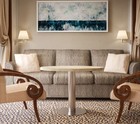
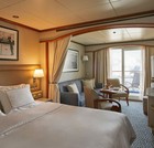
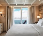
Some Vista Suites accommodate 3 guests. 240 SQ FT / 22 M2 Large picture window providing panoramic ocean views, Sitting area, Twin beds or queen-sized bed, Marbled bathroom with shower (some with tub/shower combination), Walk-in wardrobe with personal safe, Vanity table with hair dryer, Writing desk, Flat screen television with satellite reception, Direct-dial telephone, One hour complimentary WiFi access per guest/per day. ALL SUITES FEATURE - Butler service, Refrigerator and bar setup stocked with your preferences, European bath amenities, Pratesi® fine bed linens and down duvet covers, Premium mattresses, A choice of pillow, Plush robes and slippers, Personalised stationery, Binoculars, Umbrella, Complimentary Interactive mobile content

Veranda Suite. From

$142,400 AUD pp
Veranda Suite. From
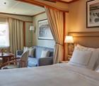
Some Veranda Suites accommodate 3 guests. 295 SQ FT / 27 M2 incl. veranda (Veranda: 49 SQ FT / 4.5 M2) Teak veranda with patio furniture and floor-to-ceiling glass doors, Sitting area, Twin beds or queen-sized bed, Marbled bathroom with shower (some with tub/shower combination), Walk-in wardrobe with personal safe, Vanity table with hair dryer, Writing desk, Flat screen television with satellite reception, Direct-dial telephone, One hour complimentary WiFi access per guest/per day. ALL SUITES FEATURE - Butler service, Refrigerator and bar setup stocked with your preferences, European bath amenities, Pratesi® fine bed linens and down duvet covers, Premium mattresses, A choice of pillow, Plush robes and slippers, Personalised stationery, Binoculars, Umbrella, Complimentary Interactive mobile content

Deluxe Veranda Suite. From

$172,300 AUD pp
Deluxe Veranda Suite. From
Some Veranda Suites accommodate 3 guests. The Midship Veranda Suite offers preferred central location with identical accommodation to a Veranda Suite. 295 SQ FT / 27 M2 incl. veranda (Veranda: 49 SQ FT / 4.5 M2). Teak veranda with patio furniture and floor-to-ceiling glass doors, Sitting area, Twin beds or queen-sized bed, Marbled bathroom with shower (some with tub/shower combination), Walk-in wardrobe with personal safe, Vanity table with hair dryer, Writing desk, Flat screen television with satellite reception, Direct-dial telephone, One hour complimentary WiFi access per guest/per day. ALL SUITES FEATURE - Butler service, Refrigerator and bar setup stocked with your preferences, European bath amenities, Pratesi® fine bed linens and down duvet covers, Premium mattresses, A choice of pillow, Plush robes and slippers, Personalised stationery, Binoculars, Umbrella, Complimentary Interactive mobile content

Medallion Suite. From

$216,600 AUD pp
Medallion Suite. From
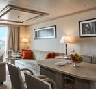
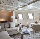
437 ft² / 40.6 m² Including veranda (81 ft² / 7.6 m²) Flat-screen television(s) with Interactive Media Library, Teak veranda with patio furniture and floor-to-ceiling glass doors, Living room (with convertible sofa to accommodate an additional guest), Sitting area, Separate dining area, Twin beds or queen-sized bed, Marbled bathroom with shower, Walk-in wardrobe with personal safe, Vanity table with hair dryer, Writing desk, Bose® Sound Touch 30 with Bluetooth connectivity. ALL SUITES FEATURE - Butler service, Refrigerator and bar setup stocked with your preferences, European bath amenities, Pratesi® fine bed linens and down duvet covers, Premium mattresses, A choice of pillow, Plush robes and slippers, Personalised stationery, Binoculars, Umbrella, Complimentary Interactive mobile content

Silver Suite. From

$292,400 AUD pp
Silver Suite. From
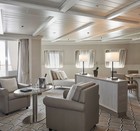
Silver Suites accommodate 3 guests. 541 SQ FT / 50 M2 incl. veranda (Veranda: 92 SQ FT / 8 M2) Teak veranda with patio furniture and floor-to-ceiling glass doors, Living room (with convertible sofa to accommodate an additional guest), Sitting area, Separate dining area, Twin beds or queen-sized bed, Marbled bathroom with shower, Walk-in wardrobe with personal safe, Vanity table with hair dryer, Writing desk, Flat screen television with satellite reception, Bang & Olufsen® audio system, Illy® Espresso machine, Direct-dial telephone, Unlimited complimentary WiFi access ALL SUITES FEATURE - Butler service, Refrigerator and bar setup stocked with your preferences, European bath amenities, Pratesi® fine bed linens and down duvet covers, Premium mattresses, A choice of pillow, Plush robes and slippers, Personalised stationery, Binoculars, Umbrella, Complimentary Interactive mobile content

Royal Suite. From

$619,500 AUD pp
Royal Suite. From
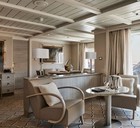
Stately. Commanding and majestic. Perfect for relaxing after a days’ exploring and looking through your photos. With lectures being streamed live to your room, this is the pinnacle of good living at sea. Available as a one-bedroom configuration or as two-bedroom by adjoining with a Veranda Suite. One bedroom: 69 sq.m. including veranda Two bedroom: 96 sq.m. including veranda

Grand Suite. From

$649,800 AUD pp
Grand Suite. From
Expertly designed and exquisitely appointed. The ideal space for sharing stories with fellow explorers and new friends. With enough space to roam both in and outside, this suite is perfect relaxing and recounting the highlights of your day. Available as a one-bedroom configuration or as two-bedroom by adjoining with a Veranda Suite. One bedroom: 95 sq.m. including veranda Two bedroom: 122 sq.m. including veranda

Owner's Suite. From

$675,800 AUD pp
Owner's Suite. From
Owner's Suite This stylish apartment offers the superlative in levels of space, comfort and service on board. A perfect mix of expedition experience with luxury lifestyle. Available as a one-bedroom configuration or as two bedroom by adjoining with a Vista Suite. One bedroom: 55 sq.m. including veranda Two bedroom: 77 sq.m. including veranda

Vessel Type: Luxury Expedition

Length: 157 m

Passenger Capacity: 200/260

Built: 1994 Refurbished & Rebranded: 2017

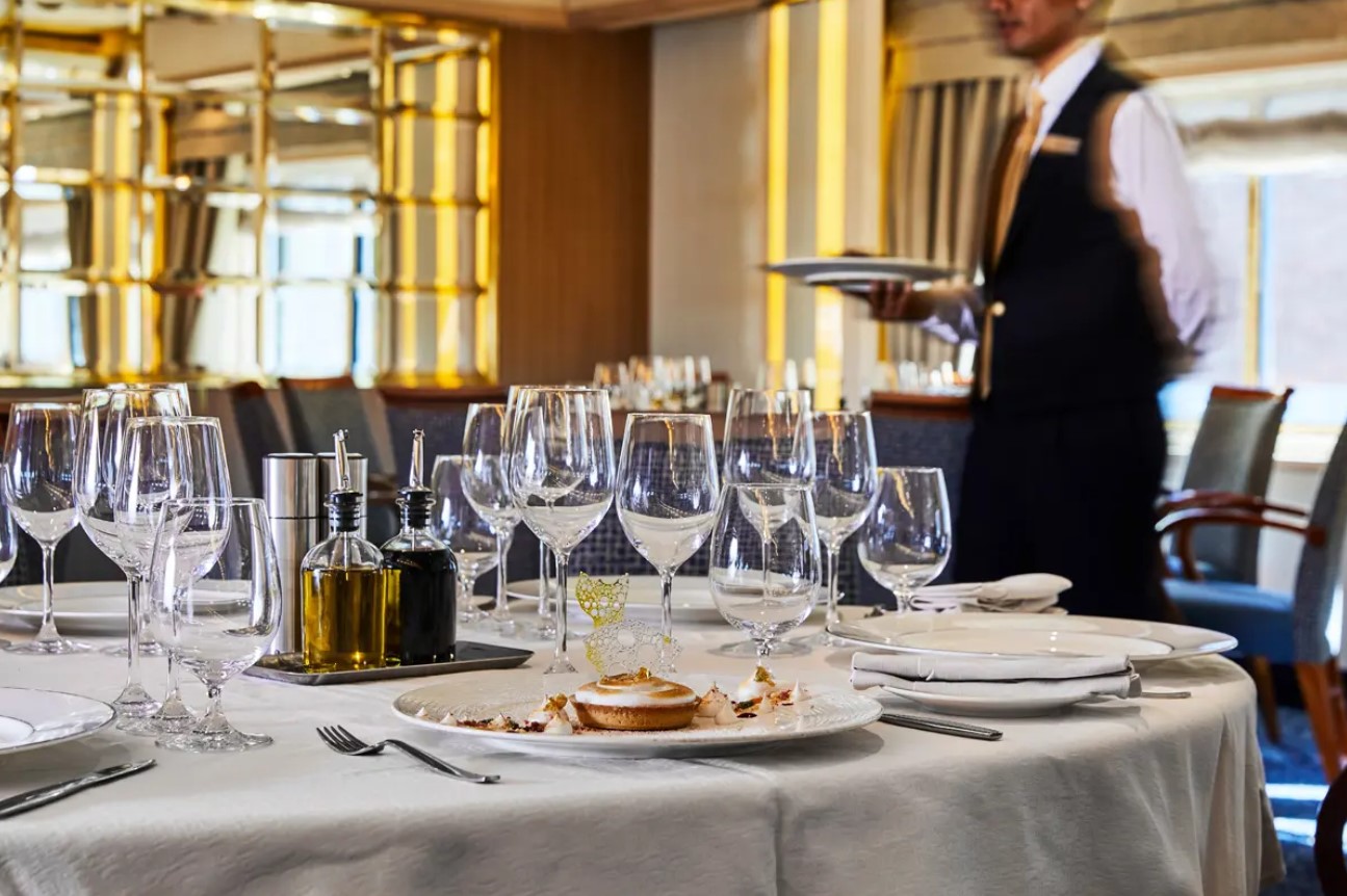
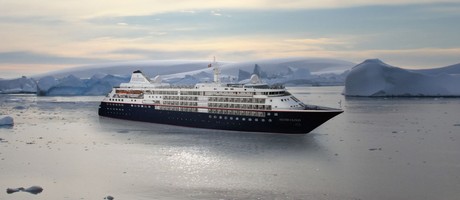
After extensive refurbishment, Silver Cloud will be the most spacious and comfortable ice class vessel in expedition cruising. Her large suites, her destination itineraries and her unparalleled service make her truly special. Her five dining options will tantalise your taste buds and as 80% of her suites include a veranda, watching a breaching whale or a few cavorting penguins has never been so personal. Broad sweeping decks with multiple open spaces and a swimming pool complete what is surely the most distinctive expedition ship sailing today.

A limited number of guests, particularly with just 200 in polar waters, mean that Silver Cloud has the highest space to guest and crew to guest ratios in expedition cruising. With her 18 zodiacs, possibilities are almost limitless with ship-wide simultaneous explorations. Finally, a team of 19 passionate and dedicated experts are always at hand to ensure your voyage is enhanced every step of the way.

DECK 09 - Observation Lounge, Jogging Track

DECK 08 - Pool, Pool Bar, Hot Rocks, The Panorama Lounge, The Connoisseur’s Corner

DECK 07 - La Terrazza, The Spa at Silversea, Beauty Salon, The Library

DECK 06 - Lecture Theatre, The Fitness Centre, Reception/Guest Relations, Expedition Desk

DECK 05 - The Bar, Boutique, Casino

DECK 04 - Main Restaurant, Le Champagne, Launderette

Cabin layout for Silver Cloud

Optional tours and excursions available. Please contact us for more details.

Inclusions


• Voyage on board in selected cabin category
• Butler service in every suite
• All meals on board*
• Beverages on board (Select wines, spirits and non-alcoholic beverages)
• Crew Gratuities (Excluding Spa & salon staff)
• Expedition excursions
• Lectures and entertainment on board
• Free wif-fi (Subject to coverage)
• Laundry service included for certain fare categories
• Self service laundry facilities available
• In country flights where required by the itinerary
*Some onboard restaurants incur an additional cost
• PRIVATE EXECUTIVE TRANSFERS
• INTERNATIONAL FLIGHTS - BUSINESS CLASS
• AIRPORT TRANSFERS
• HOTEL

Exclusions


• International flights unless otherwise stated
• Passport and visa costs if applicable
• Travel insurance
• Optional shore excursions
• Spa and Salon Treatments
• Complete valet services, including laundry, pressing and dry cleaning, are available at an additional charge
Silver Cloud
Australia Luxury Small Ship CruiseLuxury Small Ship Cruise
78 Days from
$1,539 AUD per day

or call us on

NZ Freephone
0800 945 3327

AUS Freephone
1800 107 715

to help you make your reservation

Get Our Latest Brochure

Featuring the latest small ship cruises to a number of destinations, our Small Ship Cruising brochure is carefully curated to include small ship cruises from expeditions to luxury cruises to the world's most fascinating destinations including Alaska, Croatia, the Galapagos and the Antarctic and Arctic.

Our Associates Include

Adventure Canada
Heritage Expeditions New Zealand
UnCruise Adventures
Hurtugruten
Ponant
Pandaw