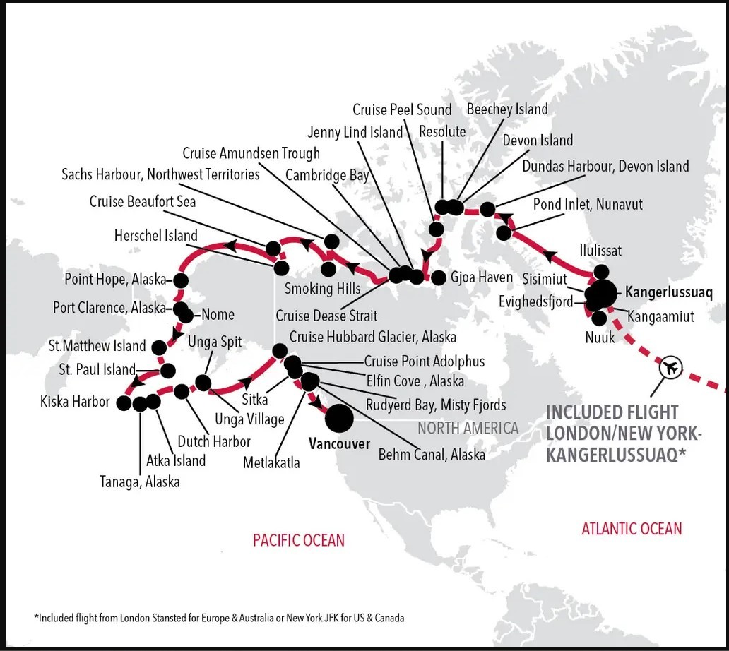
Kangerlussuaq to Vancouver - 45 Day Northwest Passage Luxury Expedition Cruise
Highlights
• Greenland Exploration: Your cruise takes you through the stunning landscapes of Greenland, with stops in Kangaamiut, Nuuk, Sisimiut, and Ilulissat. These destinations offer a mix of cultural experiences and natural wonders, including the chance to witness massive icebergs in Ilulissat.
• Canadian Arctic Adventure: After leaving Greenland, you'll head to Canada, visiting Pond Inlet and Dundas Harbour. These locations provide opportunities for wildlife encounters and exploring the pristine Arctic environment.
• Historic Exploration: Your journey takes you to significant historical sites like Devon Island, Beechey Island, and Gjoa Haven. These locations are steeped in Arctic exploration history, and you'll have the chance to learn about the expeditions of the past.
• Alaskan Beauty: As you reach the United States, your cruise continues through the scenic beauty of Alaska. Stops in Point Hope, Nome, St. Paul Island, and Dutch Harbor offer a chance to explore Alaska's unique culture and wildlife, including a visit to the magnificent Hubbard Glacier.
|
Book now |
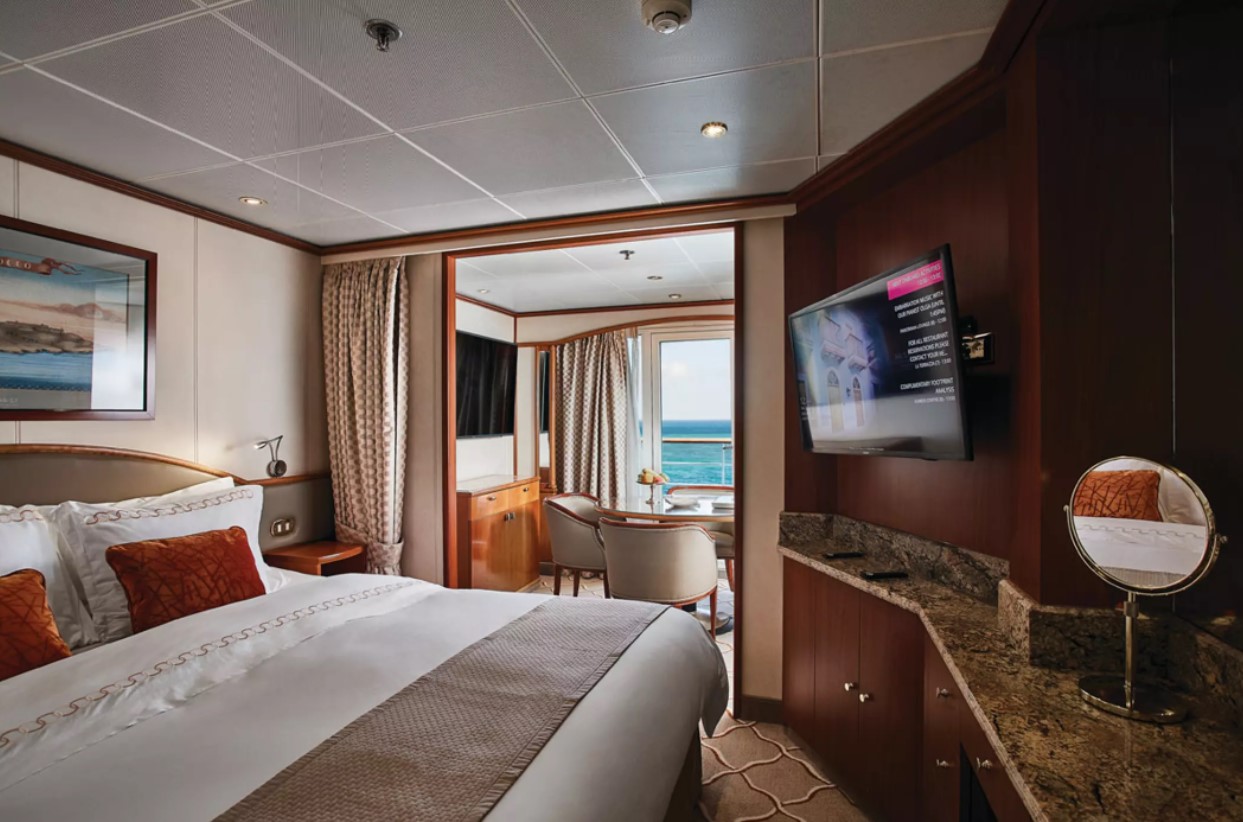
VISTA SUITE. From
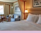
CLASSIC VERANDA SUITE. From
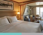
GRAND SUITE. From
DELUXE VERANDA SUITE. From
OWNER’S SUITE. From
MEDALLION SUITE. From
SILVER SUITE. From
ROYAL SUITE. From
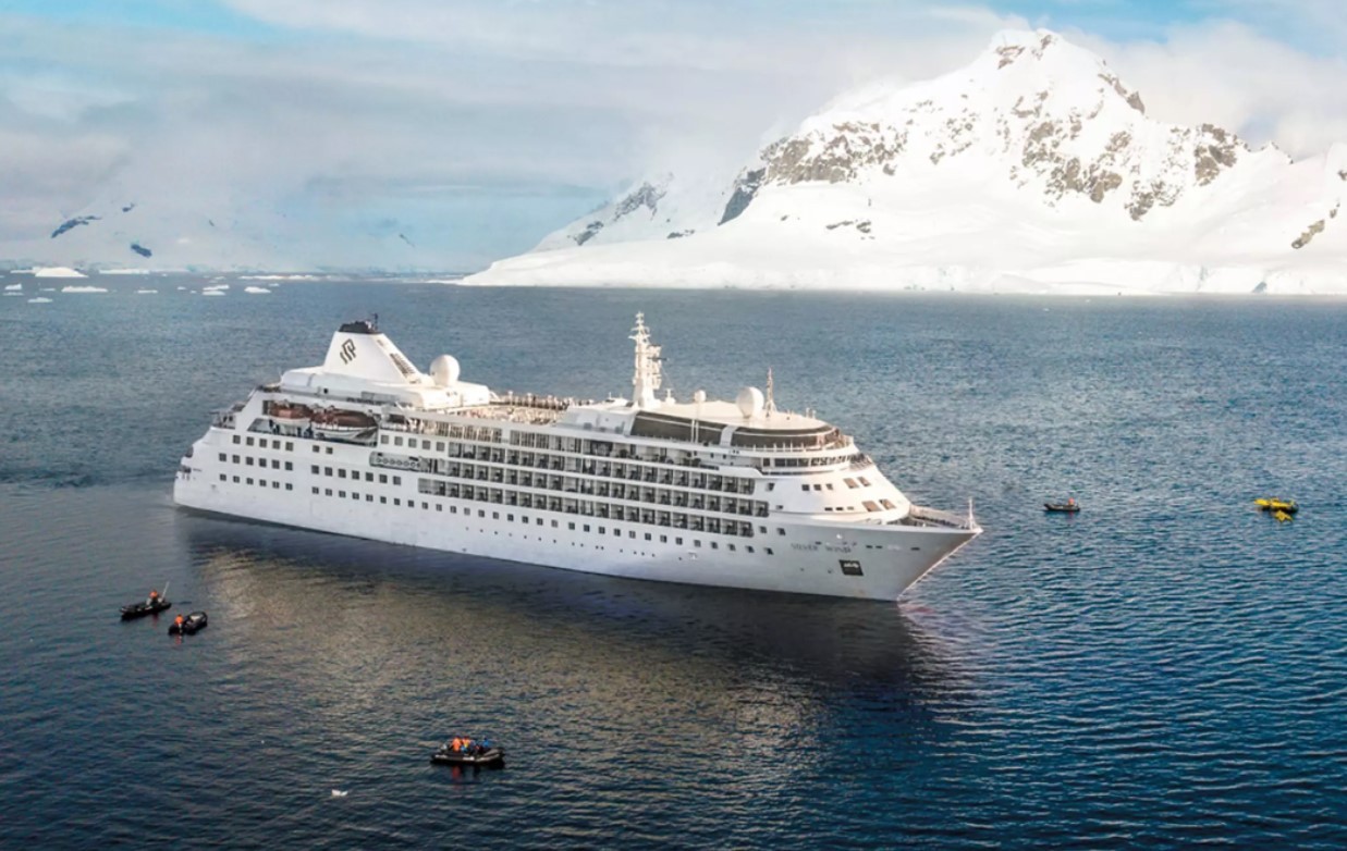
Vessel Type: Small Luxury Cruise Ship
Length: 156.7 metres
Passenger Capacity: 274
Built: 1995 / Refurbished: 2021
A major upgrade in December 2018 saw Silver Wind looking better than ever. A second refurbishment in summer 2021 will see her benefitting from a strengthened to ice-class hull and will make her one of the most adaptable ships in our fleet. Still timelessly elegant, still luxuriously relaxed, her improved cruising versatility means she is able to whizz from the Polar Regions at the ends of the earth to the iconic ports of the Mediterranean with fluid ease. So whether you want to get up close and personal to penguins in Antarctica or laze on the golden sands of the Caribbean, get ready for a wealth of diverse destination experiences, in traditional Silversea comfort.
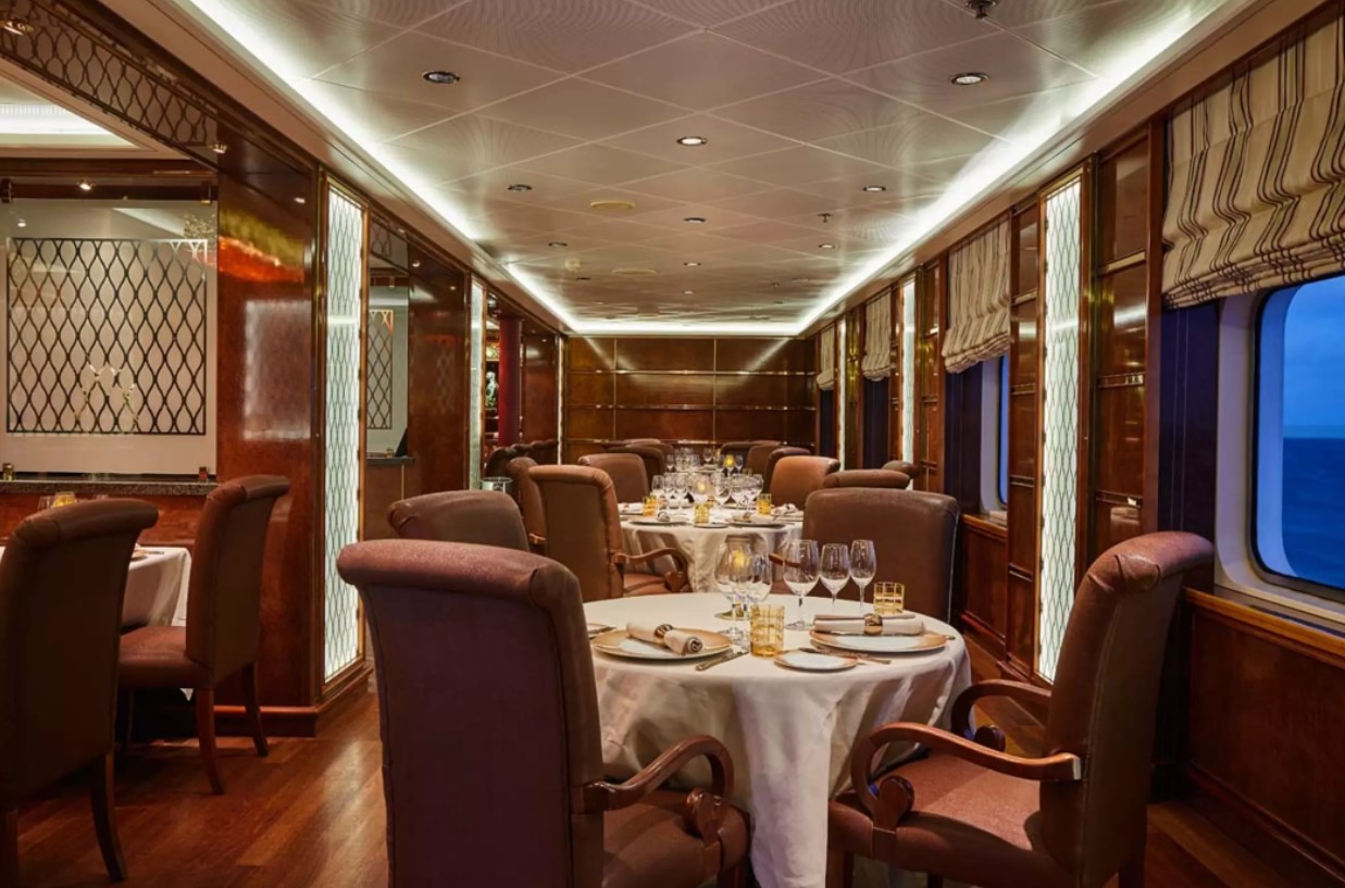
Dining
The Grill. Soft breezes and ocean views beckon at the Grill, especially as the sun goes down when cruise guests gather for cocktails at the outdoor bar and talk about the day’s events.
La Terrazza. Authentic Italian recipes and the freshest, sustainable ingredients come together in this restaurant at sea.
The Restaurant. Enjoy Continental and regional specialities, as well as sweeping ocean views in our main dining room.
La Dame. La Dame features a menu of seasonally inspired dishes prepared with the freshest locally sourced ingredients.
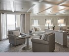
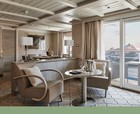
Public Areas
Pool Deck. Chaise lounges arranged in the sun or shade. Bubbling whirlpools. The pool water refreshing in warmer climates, heated for cooler weather.
Reception. Be sure to visit the Reception area, where our experts can provide invaluable information to help you get the most out of your cruise.
Fitness Centre. The Fitness Centre offers world-class equipment, classes, and personalized services.
Connoisseur’s Corner. If you appreciate good cognac or premium cigars, be sure to visit the Connoisseur’s Corner to see the ship’s exceptional selection.
Boutique. There is a wealth of luxury shopping experiences aboard all Silversea ships, featuring the most distinctive and appealing brands from across the globe.
The Show Lounge. Applaud a broad spectrum of entertainment — from full-scale production shows and classical soloists, to cultural entertainment and feature films.
Panorama Lounge. Relax and unwind in the Panorama Lounge, a sophisticated yet amicable space offering beautiful ocean views as you enjoy your cruise.
Zagara Beauty Spa. Come and indulge in a luxurious spa treatment. Facials, body wraps, massages: the spa is the perfect place to unwind.
Dolce Vita. Dolce Vita is the gathering place for our savvy travellers of the world, a place where guests mingle and exchange stories and where new faces become lifelong friends.
Zagara Beauty Salon. Maintain your fresh look throughout your luxury cruise at the Zagara Beauty Salon. Services are available for men and women.
Observation Library. The Observation Library boasts exceptional views overlooking the ocean as it stretches out below you while you enjoy your cruise.
Photo Studio. The Photo Studio offers a professional space for budding photographers to retouch, print and display their work.


Optional tours and excursions available. Please contact us for more details.
Inclusions
• Voyage on board in selected cabin category
• Butler service in every suite
• All meals on board*
• Beverages on board (Select wines, spirits and non-alcoholic beverages)
• Crew Gratuities (Excluding Spa & salon staff)
• Expedition excursions
• Lectures and entertainment on board
• Free wif-fi (Subject to coverage)
• Laundry service included for certain fare categories
• Self service laundry facilities available
• In country flights where required by the itinerary
*Some onboard restaurants incur an additional cost
• PRIVATE EXECUTIVE TRANSFERS
• INTERNATIONAL FLIGHTS - ECONOMY CLASS or Business Class upgrade at reduced rates
• AIRPORT TRANSFERS
• HOTEL
• CHARTER/GROUP FLIGHTS
Exclusions
• International flights unless otherwise stated
• Passport and visa costs if applicable
• Travel insurance
• Optional shore excursions
• Spa and Salon Treatments
• Complete valet services, including laundry, pressing and dry cleaning, are available at an additional charge
Our Associates Include
